

GeoFlyer Europe 3D Maps app for iPhone and iPad
Developer: GeoMind
First release : 14 Aug 2014
App size: 55.79 Mb
How would you like a mapping app with routing and GPS tracking that offers you the BEST 3D VISUALIZATION for the outdoors?
How would you like a mapping app that shows points of interest in 3D with info or links to embedded Wikipedia pages?
How would you like a mapping app that works OFFLINE, too?
GeoFlyer 3D Maps offers you all this and more!
If you love hiking, biking, horseback riding, or any other outdoor activity, GeoFlyer 3D Maps is the app you need.
MAIN FEATURES
- Online and Offline modes (with preloading of selected areas)
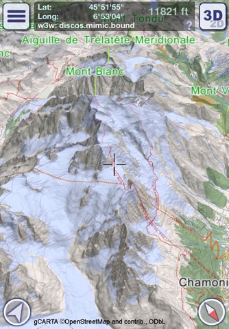
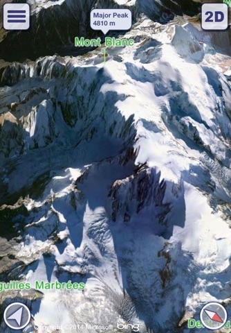
- Highly-detailed 3D terrain
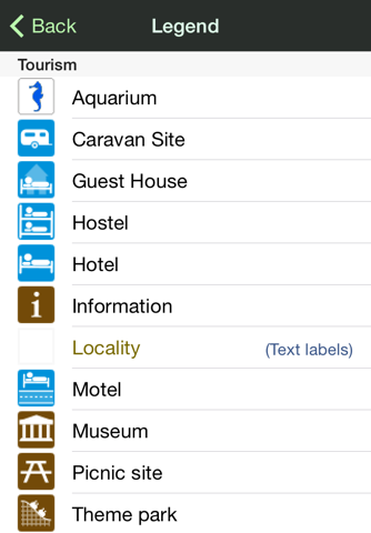
- 3D labels/icons of Points of Interest (POIs)
- Integrated Wikipedia descriptions
- Place searching by name (Online and Offline)
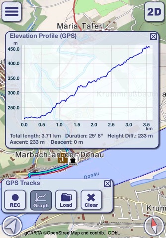
- GPS tracking
- Routing
- Personal Points of Interest (POIs)
- Sync of tracks and routes on all your devices (iCloud)
- Altimetry graph and statistics
- Custom-made gCARTA topographic chart
- Gyroscope features: GyroPilot and First Person View (Immersive Reality)
GeoFlyer 3D Maps Europe reproduces the terrain in 3D with stunning details, using the best available digital elevation models from NASA and various European mapping agencies.
The terrain is overlaid with a custom-made topographic chart (gCARTA) that shows trails and accurate elevation contour lines, or aerial images if you prefer.
Find out more about a POI using the labels and icons. Wikipedia geo-tagged entries and other associated content are integrated right into the 3D map.
Plan your trip using multiple routing options, and save your routes for later use.
Record your GPS tracks and share them with your friends through Facebook or other social media.
Get the best from your outdoor experience with the “First Person View” mode, a sort of augmented reality feature that enables you to see a virtual 3D view of what is in front of you, allowing you to identify peaks and other landmarks.
And it’s fun! Try the GyroPilot mode: dive into the valleys with a low level flyby, handling your device like a virtual plane, and explore the maps like a top-gun pilot!
GeoFlyer 3D Maps… your outdoor companion!
WARNING
Continued use of GPS running in the background can dramatically decrease battery life.
Latest reviews of GeoFlyer Europe 3D Maps app for iPhone and iPad
This app is fantastic. I love the choice of topo+satellite, I love the deep 3D... this is the way to plan a trip, with paper map on trial. Inspirational if youre going, because you realize just what kind of shape you need to be in before you get there. Also frustratingly great for living vicariously, if you cant get there in person; but this and a bookshelf full of guidebooks and True Tales of the Mountains and you are going to be all set for a lifetime of evenings.
We recently used the full Europe version for our Haute Route Trek, hiking from Chamonix to Zermatt, as our primary navigation tool. It was excellent.